File:3D locations in Google Earth.png
Size of this preview: 800 × 410 pixels. Other resolutions: 320 × 164 pixels | 640 × 328 pixels | 1,436 × 736 pixels.
Original file (1,436 × 736 pixels, file size: 51 KB, MIME type: image/png)
Summary
| Description |
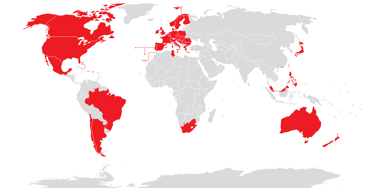
English: Countries which have regions available in Google Earth as a three dimensional model |
| Date | |
| Source | Own work |
| Author | Eugen Simion 14 |

|
File:3D locations in Google Earth.svg is a vector version of this file. It should be used in place of this PNG file when not inferior.
File:3D locations in Google Earth.png → File:3D locations in Google Earth.svg
For more information, see Help:SVG. |
 |
Licensing
I, the copyright holder of this work, hereby publish it under the following license:
| This file is made available under the Creative Commons CC0 1.0 Universal Public Domain Dedication. | |
| The person who associated a work with this deed has dedicated the work to the public domain by waiving all of their rights to the work worldwide under copyright law, including all related and neighboring rights, to the extent allowed by law. You can copy, modify, distribute and perform the work, even for commercial purposes, all without asking permission.
|
File history
Click on a date/time to view the file as it appeared at that time.
| Date/Time | Thumbnail | Dimensions | User | Comment | |
|---|---|---|---|---|---|
| current | 01:26, 2 November 2019 | | 1,436 × 736 (51 KB) | wikimediacommons>Owen313 | New 3D Maps in Serbia. Pink means countries with former 3D Maps (Taiwan). |
File usage
The following 2 pages use this file: